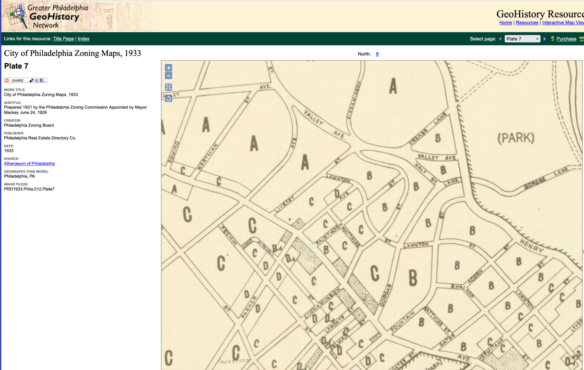
I was looking through old maps of Philly and found a plat map from 1933 of my old neighborhood in Roxborough. Roxborough is a suburb within the City of Philadelphia, in the northwest “wing” of the city. What I found interesting about this map is that the streets in the area where I lived from 1956 to about 1966 were already in place and named long before we moved there. I had thought that when we moved there the neighborhood was relatively new and undeveloped in 1956 but, on the contrary, all of the streets I was familiar with were already in existence at least 23 years before we moved in.
I call your attention to upper center of the map, at the intersection of Livezey Street and Lawnton Street. That was where our house was situated but not yet built as it wasn’t to be built until about 1954. To find the exact location of our house once must go to that intersection and then extend Lawnton Street further to the Northwest. This is because our small development had not yet been built and Lawnton Street had not yet been extended. Our house sat on the northwest corner of that intersection. Our address was 6900 Lawnton Street, although it could have been 549 Livezey Street. However, my father always said that he wanted to live of “Easy Street” but “Live-ezy” was about as close as he was going to get.

Leave a comment